|
Directions: Take I-75 to Exit #314 (Hwy 48), then
head west to US-41 at Floral City. Go north on US-41 to Inverness.
Potts Preserve WMA is located on CR-581 about 9 miles northeast
of US-41. Where US-41 and SR-44 diverge on the north side of Inverness,
look for CR-581 heading north-northeast toward the Withlacoochee
River. Follow CR-581 to Dee River Ranch Road or to Hooty Point
Road. Dee River Ranch Road takes you to the western (or equestrian)
gate into the property. Hooty Point Road goes to Turner's Fish
Camp. Just before entering Turner's Camp, the entrance to Potts
is on the left.
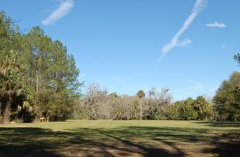
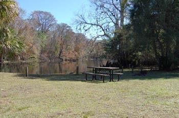
Potts Preserve WMA is a wet area subject to flooding during periods
of heavy rainfall. The lower parts of this 20 mile trail may occasionally
be swamped. Mosquitoes and biting flies may be a problem during
warm weather. At this time, there is a lot of airboat traffic
on the western side of Potts. The river side offers a beautiful
trail with wildflowers in spring and fall and abundant wildlife.
Get Driving
Directions
Map of Potts
Preserve Hiking Trail
Contact Trail Master/Activity Leader
|