|
The Citrus Hiking Trail is located about 15 miles
north of Brooksville and southwest of Inverness. From Brooksville,
travel north on US 41 to CR 481. Take CR 481 north (it will become
CR 581 when you enter Citrus County) to FR 16 to enter the Mutual
Mine Recreation Area where you will find the trailhead at the
edge of the campground, next to the rest rooms. You can also continue
farther north on CR 581 to Trail 10, which will take you to the
Holder Mine Recreation Area. The trailhead is located on the south
side of FR 10 near the intersection of FR 10 and FR 9.
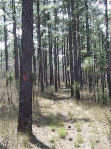
There are four connected loop trails totaling about 47 miles.
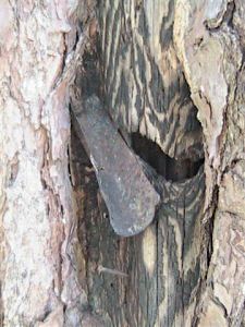
The main hiking trails are marked with an orange blaze. The side
trails and crossover trails are marked with a blue blaze. We share
this area with horse riders and their trails which have a single
or double painted band twelve inches high which goes all the way
around the tree. The hiking trails are closed to horses, but hikers
are permitted to use the horse trails.
The newly designated section on the Florida National Scenic Trail
in Citrus County begins on CR 480 and continues north, following
the east side of the loop trails. After a half mile road walk
on CR 581 (signed and marked) it goes through Whispering Pines
Park and connects to the Withlacoochee State Trail.
Citrus tract is a dry site. You
must carry in all your water. A water tap is available
at Holder Mine, Mutual Mine and Tillis Campgrounds. There is no
other potable water available on the property. There are three
primitive campgrounds located on B, C and D loops.
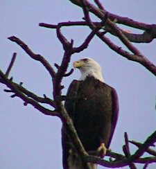
Visit Citrus
Wildlife Management for information about wildlife you might
see in Citrus.
Map of Citrus
Hiking Trail
Contact Trail Master/Activity Leader
|